Stoke St Gregory History Pages
West Sedgemoor BACK to Moors
Although some evidence has been found of earlier drainage channels on West Sedgemoor, it was only in the 19th Century that the present system of ditches, rhynes and drains were created. Two clyses (or sluices) had, until then, allowed water to flow into the River Parrett at low tide. The northern one was under the little hump in the road by "Hill View". Further up river was Sedgemoor Clyse, near the old Black Smock pub. The southern section was (and still is) fed by a stream arising in West Hatch. The map below shows the original two separate drainage systems. The name 'Walsey Mere' is worthy of further exploration (anyone interested??). In Anglo Saxon the name means "the lake by the foreigners island". The adjoining land is still called Walsey Batch, batch being another saxon name referring to a beach or a raised piece of land.

“He Feeds his Geese at Sedgemoor” This local 18thC saying refers to anyone who made their money at the expense of others. In particular, the people of Stoke made considerable amounts from grazing their flocks of geese for nothing on West Sedgemoor. It was common land, and was yet to be enclosed and drained. The mass produced metal pen nib had yet to be invented, so goose feathers were in great demand. The flocks on West Sedgemoor were counted in thousands. One Victorian traveller thought he was looking down on an area covered in snow. A Mr Marshall travelled through the area in 1794 and wrote: ‘The myriads of Geese are incalculable. The whole are subjected to the operation of “pulling.” They are now (13 September) covered with down only. The operation, I was informed, is repeated several times in the course of the summer; and found very profitable. They are kept on the “Moor” all winter. In long-continued frost and snow, they are fed with Beans.’
Enclosure The final enclosure of West Sedgemoor took place in the first quarter of the 19th Century, and produced the network of ditches, rhynes & drains that we know today, but the water still only flowed to the River Parrett through two clyses at low tide. There was no pumping station. The 'Main Drain' was what is now called 'Middle Drain'. This was built after tenders were put out for the various sections, with different widths and depths. This advert appeared in the Taunton Courier in 1817:
"WEST SEDGEMOOR DRAIN - TO BE LET
At the King Alfred Inn, Borough Bridge, in the county of Somerset, on Tuesday the 29th day of August at eleven o' clock in the forenoon, before the Commissioners names in an Act of Parliament, for enclosing West Sedgemoor, in the county of Somerset."
There were 7 lots to be tendered for, of half a mile each. Each half mile had a different profile. At Thong Farm it was to be eleven feet at the top, four feet at the bottom, and four feet wide. By the time it reached the clyse at the Parrett it was to be fifteen feet wide at the top, six feet wide at the bottom, and four and a half feet deep.
Nothing much had changed by the 1930s, when this second edition of the Ordnance Survey was revised. Sedgemoor Clyse is by the Black Smock (then called the George). Sedgemoor Old Rhyne discharged at Stathe Clyse, just downstream from where the straightened Main Drain now meets the pumping station on the Parrett. These clyses had also been put out to tender in 1817, noting in the Taunton Courier that: "they are ready to CONTRACT for the ERECTING and BUILDING TWO BRIDGES, over two Cuts or Drains, from the said moor into the River Parratt"

A New Road


Oath Drove
E - G on the Map
The network of droves and footpaths, were all given names - Hunthamland Moor Drove (down from I&M), Junction Drove, Summers Drove, Fosters Drove, Bites Drove, etc, and were built to enable the new landowners to access their individual plots. The Commissioners also named the new bridges - Potters Bridge, Ridley Corner Bridge, Collins's Bridge. Pinneys Drive Bridge, etc.
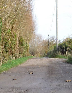
Alongside this work was the construction of an access road for all the parishes that had been allocated land on West Sedgemoor. This was to be shared according to the amount of land held. Stoke St Gregory was responsible for section A, and North Curry for section B on the map. West Hatch, Oath (Lyng), Curry Mallett, Broadway, and all the other parishes had their own responsibilities.

Stretches L - G on the Map
